

Executive Summary
As the low-altitude economy enters a phase of scaled development, airspace management faces unprecedented complexity. Traditional two-dimensional airspace management systems can no longer meet the safety, efficiency, and compliance demands posed by dense drone logistics, Urban Air Mobility (UAM), low-altitude tourism, and other emerging sectors.
This whitepaper presents the technical architecture and implementation approach of 4D airspace management, demonstrating how the Flyward 4D Airspace Platform delivers end-to-end capabilities — from situational awareness to operational management — through 3D digital twin technology, AI-powered path planning, airworthiness assessment, and fully digitized flight reporting.
1. Industry Context and Challenges
1.1 The Rise of the Low-Altitude Economy
The low-altitude economy has been included in China’s government work report for two consecutive years, establishing it as a strategic emerging industry. Over 26 provinces and municipalities have published low-altitude economic development plans, with the market projected to exceed 2 trillion RMB by 2030. Globally, Morgan Stanley projects the urban air mobility market will reach $1.5 trillion by 2040, driven by eVTOL adoption and drone logistics expansion.
1.2 Core Contradictions in Airspace Management
Low-altitude airspace management faces three fundamental tensions:
- Supply vs. Demand: Limited airspace resources versus rapidly growing flight demand. Under traditional management, airspace utilization remains low, with vast usable airspace underdeveloped due to inadequate management tools.
- Safety vs. Efficiency: Stricter safety requirements lead to more complex approval processes, reducing operational efficiency. Balancing safety assurance with operational throughput is a universal challenge.
- Standardization vs. Diversity: Different use cases (logistics, air taxis, agricultural spraying, emergency rescue) impose vastly different airspace requirements. A unified management framework must be flexible enough to accommodate this diversity.
1.3 Limitations of Traditional Approaches
- Reliance on 2D planar planning, unable to precisely manage flight activities in 3D space
- Manual approval workflows that cannot keep pace with high-frequency, short-cycle low-altitude operations
- Fragmented data across systems — weather, terrain, restricted zones stored separately
- Insufficient multi-aircraft coordination for high-density flight scenarios
2. 4D Airspace Management Technical Architecture
2.1 Design Philosophy: See, Manage, Control, Simulate
The platform is built around a four-pillar philosophy:
- See (Situational Awareness): 3D digital twin technology creates a high-fidelity airspace environment for comprehensive, real-time situational awareness
- Manage (Operational Management): Full lifecycle management covering aircraft registration, mission planning, flight reporting, and operational monitoring
- Control (Intelligent Control): AI algorithms enable path planning, conflict detection, and airworthiness assessment for intelligent decision support
- Simulate (Scenario Simulation): Digital twin environment enables flight plan rehearsal and emergency response drills, reducing real-world operational risk
2.2 Core Data Model
The platform’s data architecture is built around seven core entities:
- Airspace: Type, geometry, spatial extent, time windows, and control rules — supporting flexible multi-layer airspace structures
- Aircraft: Type, performance parameters, sensor configuration, real-time status, and mission state — from individual aircraft to fleet management
- Trajectory: Origin-destination pairs, 4D waypoint sequences, and compliance status — the core object for path planning and conflict detection
- Grid/Voxel: Discretized 3D space for spatial indexing, occupancy analysis, and path planning computation
- Weather: Real-time integration of wind vectors, temperature, pressure, precipitation, thunderstorms, and cloud layers
- Geography: Administrative boundaries, high-precision terrain, urban building models, and airport data
- Task/Event: Mission type, objectives, priority, and execution status — supporting multi-mission coordination
2.3 3D Digital Twin Airspace Engine
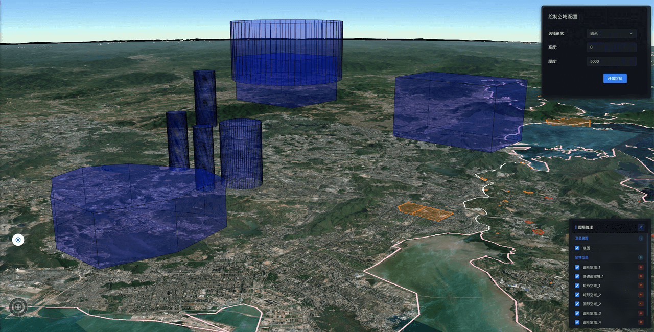
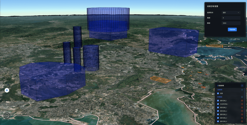
The platform leverages an industry-leading 3D earth engine to create a high-precision, interactive digital twin environment with:
- Global high-resolution terrain and building data integration at centimeter-level spatial resolution
- Real-time weather overlay with wind field, cloud layer, and precipitation visualization
- 3D display of restricted zones and controlled airspace with intuitive spatial constraints
- Multi-layer overlay and custom data source integration, compatible with third-party maps, weather services, and aircraft tracking feeds
2.4 AI Path Planning Engine
- Second-level Route Computation: Optimal route calculation in complex 3D space within seconds
- Multi-source Data Fusion: Real-time integration of terrain, restricted zones, and wind field vectors for safe, reliable routing
- Dynamic Constraint Handling: Support for on-the-fly constraint additions (temporary no-fly zones, weather changes) with automatic route replanning
- Multi-aircraft Deconfliction: Automatic conflict detection and resolution when multiple aircraft share airspace
2.5 Intelligent Airworthiness Assessment
The assessment module integrates weather, terrain, urban structures, airspace control status, population density, aircraft performance, and airport factors through an AI spatial analysis engine:
- Point Assessment: Comprehensive flight condition evaluation at any coordinate with multi-dimensional safety scoring
- Area Scanning: High-density grid scanning across designated areas, filtering optimal locations from tens of thousands of candidates
- Heatmap Visualization: Intuitive heatmap display of assessment results for rapid decision-making
2.6 Digital Flight Reporting
- 30+ built-in industry mission templates with intelligent qualification matching
- Automated compliance pre-checks to identify issues before submission
- Visual approval progress tracking and historical record management
- End-to-end online processing from application to approval
3. Application Scenarios
3.1 Urban Drone Logistics
Route planning, airspace deconfliction, and automated flight reporting for logistics operators, supporting city-scale high-density drone delivery networks with global optimization of hundreds of concurrent routes.
3.2 Urban Air Mobility (UAM)
Vertiport planning, route design, and real-time traffic monitoring for eVTOL operators and urban transport authorities, building the infrastructure foundation for future air taxi services.
3.3 Emergency Response
Rapid optimal rescue route planning and intelligent landing zone selection during disasters and emergencies, significantly reducing response times.
3.4 Airspace Regulation
Unified situational awareness platform for government aviation authorities, supporting multi-agency collaborative oversight and improving airspace resource utilization.
3.5 Research and Education
Airspace simulation and experimentation platform for universities and research institutions, supporting teaching and research in UTM, path planning algorithms, and airspace capacity assessment.
4. Value for Users
The Flyward 4D Airspace Platform brings regulators, operators and research institutions:
- End-to-end in one place: “See-Manage-Control-Simulate” on a single platform, without stitching systems together
- Open architecture: compatible with third-party map, weather and aircraft data sources, with open APIs for integration with existing systems
- Easy to adopt: the right feature level for everyone from beginners to professionals, so teams get productive quickly
- Traceable approvals: applications, approval progress and history kept online end to end, supporting oversight and review
5. Future Outlook
- Greater Autonomy: Evolution from human-assisted to AI-autonomous decision-making for fully automated airspace resource allocation
- Broader Interoperability: Standardized interfaces enabling cross-regional, cross-platform airspace management system interconnection
- Deeper Industry Integration: Embedding airspace management capabilities into logistics, mobility, and emergency vertical industry systems as core low-altitude infrastructure
Flyward is committed to building safe, open digital infrastructure for low-altitude airspace, bringing regulators, operators and the wider industry safe, efficient and intelligent airspace management. For more information or to try the 4D Airspace Platform, visit flyward.cn or contact us for a customized demonstration.