4D Airspace Platform
To ensure optimal performance, we recommend accessing this site via a desktop browser.

4D Airspace Traffic Platform
4D Air Infrastructure Platform
- 4D Airspace Platform is an advanced airspace planning and management infrastructure system designed specifically for air traffic control, flight planning, and airspace resource optimization. Based on 3D visualization technology and integrated with the time dimension, the platform enables four-dimensional management of airspace resources.
Next-generation aerial infrastructure and integrated air traffic control system
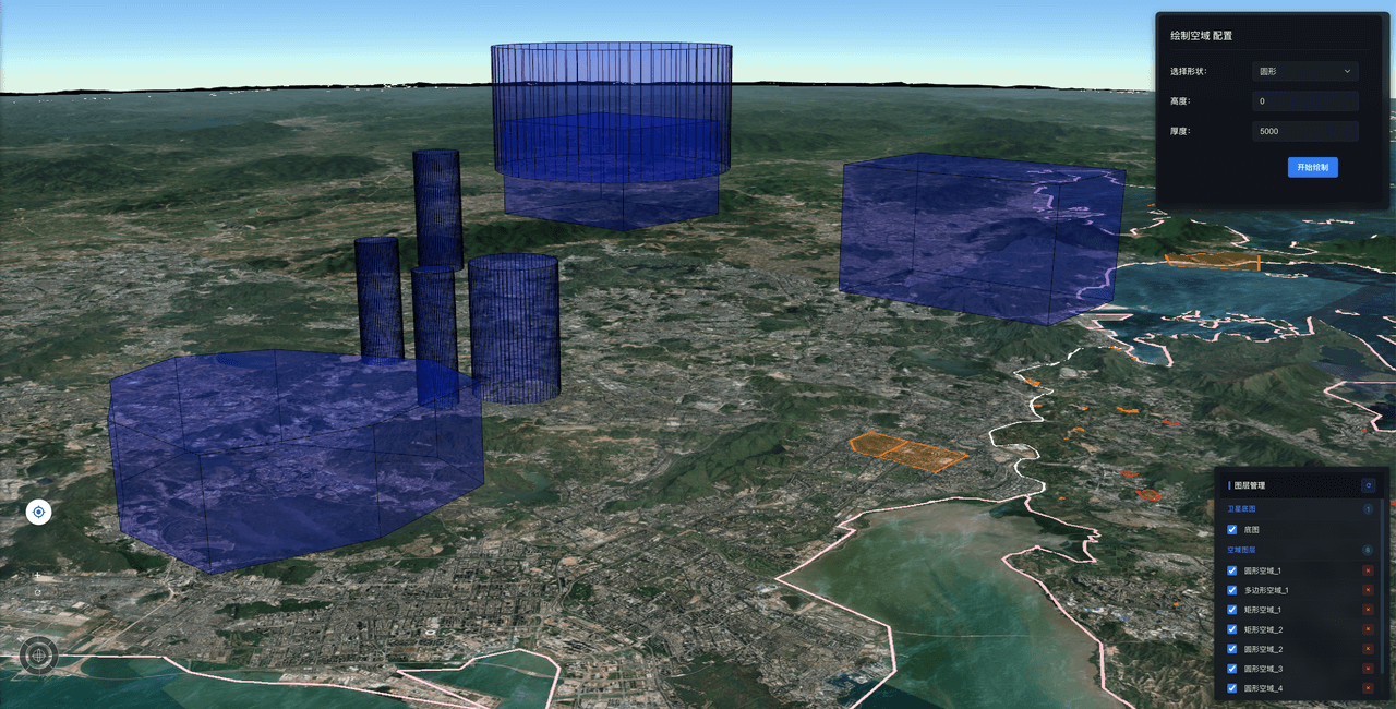
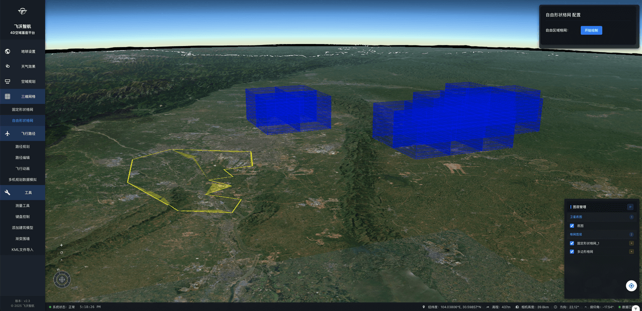
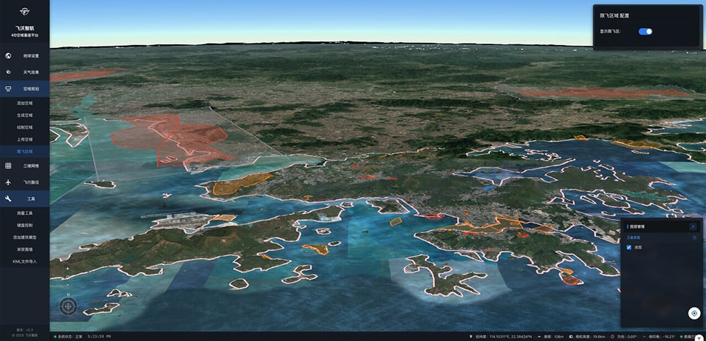
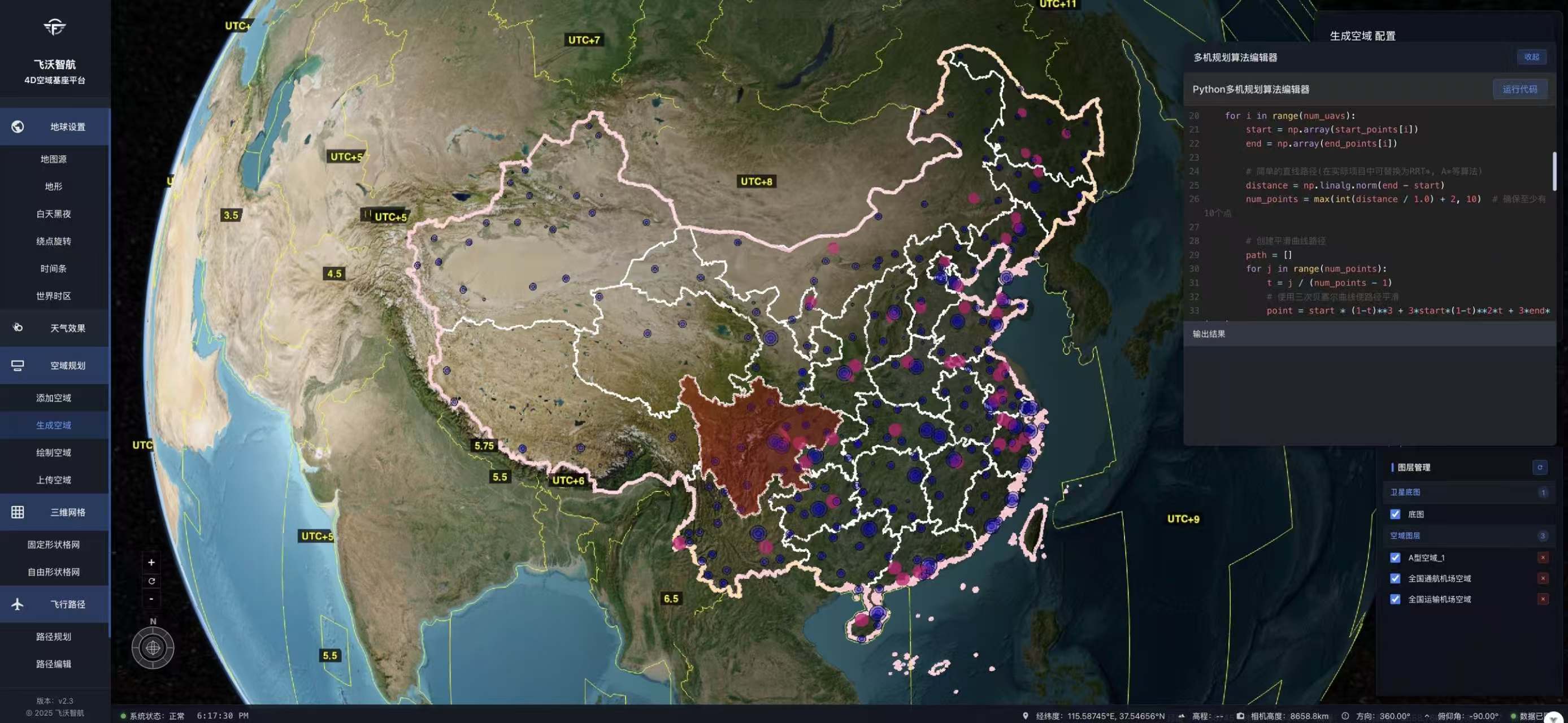
- Dynamically adjustable 3D air corridors and voxel-based grids, fused with global infrastructure data including buildings and terrain.
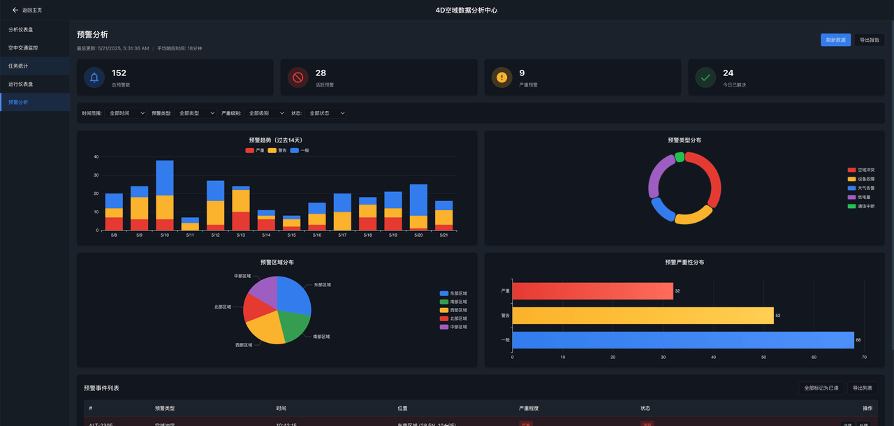
Air Traffic Data Analytics Platform
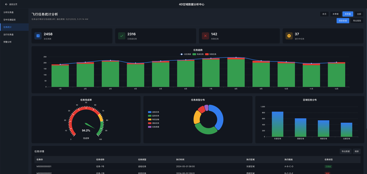
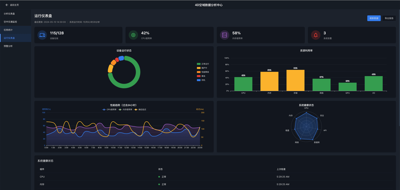
- Comprehensive flight data lifecycle management, featuring intelligent analysis, performance optimization, risk evaluation, and anomaly detection.
4D Air Infrastructure Platform
Supported by an industry level 3D Earth engine, the platform renders a high-precision, interactive digital twin environment. Users can intuitively explore global terrain and building data through a drag-and-drop 3D interface, gaining real-time situational awareness and operational control. The platform stands out with its ability to support direct intelligent interaction with AI algorithm systems in a geospatial context—enabling advanced algorithm testing, flight data analysis, and airspace decision-making support.
Accurate 3D geospatial database
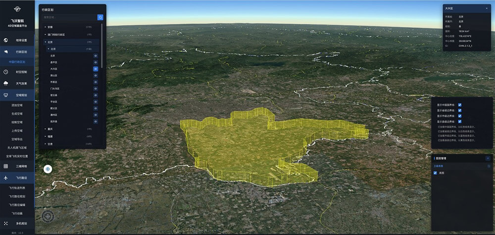
Refined airspace planning and management
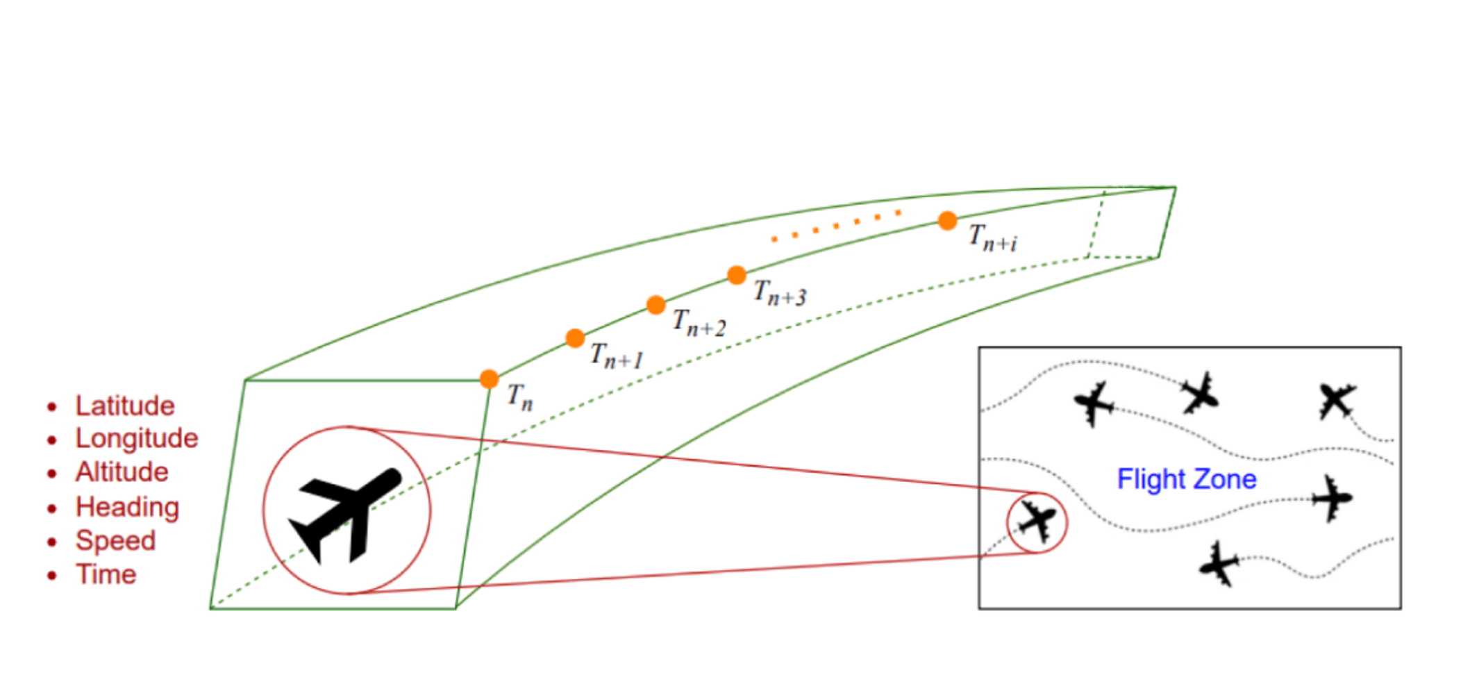
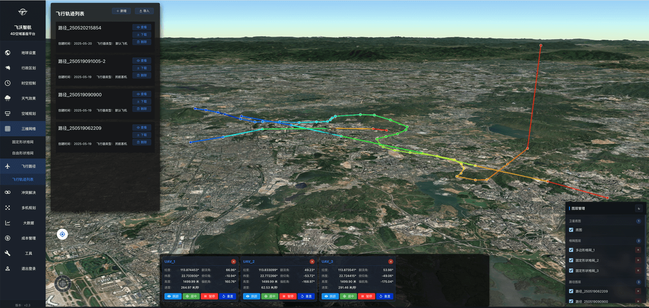
End-to-end flight trajectory planning
Comprehensive 3D environment modeling
Open architecture for algorithm integration and custom features
User-friendly and efficient user interface
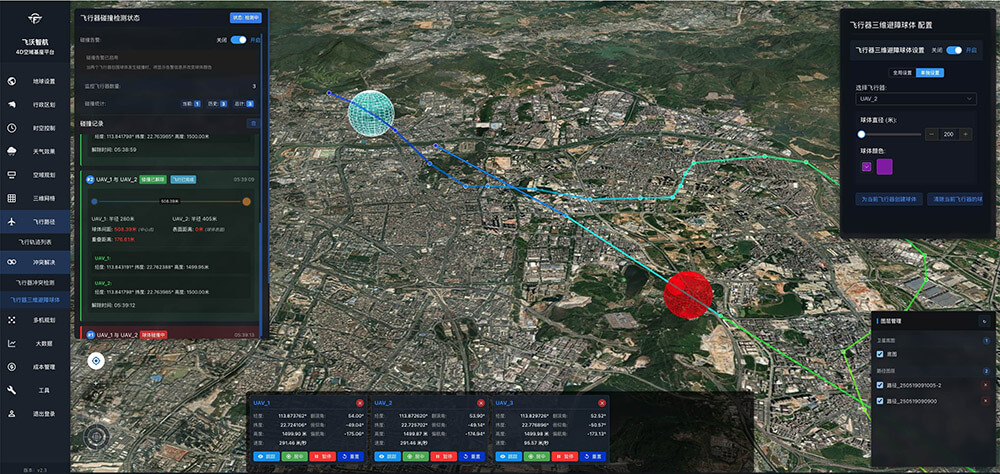
Conflict detection and automatic resolution
3D grids and flight paths
Nationwide airspace planning hierarchy


Visualization of multi-aircraft flight trajectories
Advanced 3D scene generation

Next-Generation Air Traffic Management Platform
The platform supports real-time large-scale multi-aircraft algorithms such as cooperative planning, airspace situational analysis, autonomous fleet management, and spatial computation optimization. By enabling accelerated parallel simulation and reasoning, it significantly improves fleet management capabilities, enhances airspace safety, and increases the efficiency of multi-aircraft operations and management.
Building the new “highways“ of the sky
3D Structured Airspace and 4D Route Management
Flight Data Analytics and Processing Platform
This platform is built to handle massive volumes of flight data, supporting full-cycle operations including data acquisition, cleansing, fusion, storage, and management. Through the use of intelligent algorithms, it enables deep mining and analysis of complex datasets. The system empowers users with capabilities for flight performance optimization, safety risk assessment, anomaly detection, and operational decision support—delivering true value transformation from raw data to actionable insights.
AI-Powered Integrated Platform for All Types of Aircraft
Empowering intelligent flight across dimensions, with 20+ capabilities tailored for real-world applications—ranging from inspection, airspace control, and energy optimization to data fusion and autonomous decision-making, all with the power of Flyward Large Vision Language Model


Flexible algorithm framework with full customization support

Efficient and intuitive human-machine collaboration

4D Airspace Platform
为确保最佳使用体验,请使用电脑浏览器访问。