AI Visual Navigation and Localization
Flyward delivers cutting-edge AI-based visual navigation and positioning technology for UAVs, eVTOLs, and aircraft — enabling intelligent flight with enhanced safety, precision, and efficiency.
AI Visual Navigation and Localization
Flyward delivers cutting-edge AI-based visual navigation and positioning technology for UAVs, eVTOLs, and aircraft — enabling intelligent flight with enhanced safety, precision, and efficiency.
Product Introduction
This civilian-grade AI visual navigation and localization software integrates multiple advanced modules powered by cutting-edge artificial intelligence and machine vision algorithms. Designed as a “third navigation solution” alongside GNSS and IMU systems, it enables real-time guidance for eVTOL aircraft and UAVs of various types and sizes—even in extreme environments where GNSS and inertial navigation fail and only onboard cameras remain operational.This product delivers the most accurate pure visual real-time navigation and positioning capabilities available in the Asian market. Without requiring any additional aircraft modifications, our software enables reliable visual navigation using only onboard cameras or electro-optical pods, ensuring maximum flight safety and seamless mission execution.

Key Features
Pure Visual Navigation
Autonomous real-time navigation and positioning when GNSS and IMU are unavailable.
Multi-sensor Fusion
Integrates GNSS, IMU, altimeters, and other sensors for more precise multi-source navigation.
Visual Obstacle Avoidance
Real-time detection and avoidance of obstacles in the flight path to ensure flight safety.
Real-time Monitoring
Automatically triggers visual navigation when flight control anomalies occur, ensuring continuous safe flight.
Data Recording
Complete recording of flight and attitude data for verification, analysis, and debugging.
Safety Assurance
Multiple fault detection and emergency measures enhance the robustness of algorithmic software.
Disadvantages of GNSS Global Positioning Navigation
1
GNSS signals are susceptible to malicious interference from geopolitical factors and electronic warfare, as well as urban environment shielding (such as high-rise buildings), leading to signal loss or instability.
2
In urban canyons or mountainous areas, GNSS signals reflect off buildings or terrain, causing multipath effects and significant positioning errors.
3
Changes in the ionosphere and troposphere, especially affected by solar activity and adverse weather, cause GNSS signal propagation delays, reducing positioning accuracy.
4
Failures, maintenance, or orbital drift of GNSS satellites affect signal stability and reliability, causing receivers to be unable to obtain enough satellite signals for accurate positioning.
Disadvantages of IMU Inertial Navigation
1
Accelerometers and gyroscopes in IMU drift over time, with errors accumulating over time. This is particularly noticeable during extended use and requires regular calibration to reduce cumulative errors.
2
IMU is highly sensitive to external environmental changes, especially vibrations, temperature changes, and electromagnetic interference. High-intensity vibrations can damage mechanical parts, while extreme temperatures can cause sensor performance instability or even failure.
3
Over time, mechanical parts in IMU can wear out and fatigue due to long-term use, leading to a decrease in measurement accuracy.
Product Advantages
Environmental Adaptability
Sensor Compatibility
Modular Design
Strict Airworthiness Certification
Operating System and Processor Compatibility
Customization and Configurability
Computational Resource Optimization
Advanced Feature Expansion
Subsequent upgrade installation of more advanced AI visual functions, including but not limited to
3D Perception Obstacle Avoidance
Ground Environment Recognition
Aerial Target Detection
Situational Awareness
3D Perception Obstacle Avoidance
Ground Environment Recognition
Aerial Target Detection
Situational Awareness
Application Scenarios
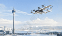
Urban Air Mobility
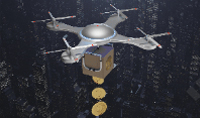
Logistics Delivery
Aerial Display

Intelligent City Management