“Airspace infrastructure is lagging” — nearly every article on the low-altitude economy says it. Very few ask the next question: lagging at what, exactly?
If the answer is “port civil aviation’s air traffic control down to low altitude,” then the road was wrong from the first step. Because we are trying to manage a sky that is turning into “3D plus time” with the 2D thinking of the radar era — and the old method must fail in the new sky.

First, do the density math
Civil aviation’s ATC manages a few thousand aircraft over a country at once, separated by kilometers, directed by human controllers watching radar. One controller can hold maybe fifteen to twenty aircraft.
What happens when low altitude scales? Over a single city there could be hundreds or thousands of drones and eVTOLs at once, separated by tens of meters, threading through the three-dimensional canyons between buildings. Put the human-controller model on top of that, and the number of controllers you’d need spins out of control. The math doesn’t balance from the start.
2D tools can’t manage a 3D problem
Radar-era ATC is, at its core, two-dimensional: latitude and longitude plus coarse altitude layers — and it is reactive: you wait until two targets are about to collide, then direct them apart.
Low-altitude traffic isn’t like that. It is genuinely three-dimensional — vertical maneuvering matters as much as horizontal — and it is too fast and too dense; by the time you react, it’s often already too late. There is only one way to manage it: raise the dimensionality of the management itself. From 2D to 4D (three dimensions plus time), from reactive to predictive. Every aircraft’s trajectory becomes a function of time, predictable in advance; conflicts are computed and resolved before takeoff, not handled at the last second in the air.
What 4D management actually means
- 4D trajectories: no longer just “where is it now,” but “where will it be at every second in the future”;
- Strategic deconfliction: resolve conflicts across the whole airspace before takeoff, instead of firefighting in the air;
- Automated dispatch: the density is too high for humans — machines schedule, and people handle exceptions;
- Digital twin: run the whole process in a simulated sky first, then put it in the real one.
Don’t pave the detour into the main road
There’s a real trap here: if the industry builds low-altitude “ATC” as a 2D retrofit of civil aviation’s system, it will hit a wall the moment scale arrives, and be forced to tear it down and rebuild. The smart move is to build 4D-native from day one — and skip the detour that’s destined for rework.
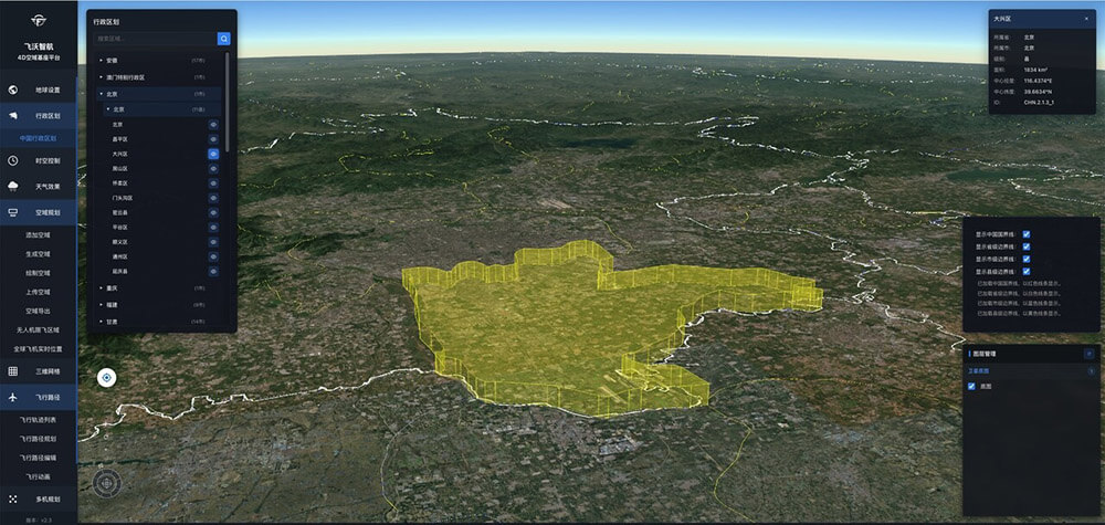
That is exactly Flyward’s technical starting point: our 4D airspace traffic management platform was designed from the beginning to bind three-dimensional space and the time dimension together. Because we understood one thing early —
the sky didn’t get more crowded; it gained a dimension, and it gained a clock. Managing it with yesterday’s flat, reactive tools is like directing air traffic with a paper map. The dimensionality of the tool has to match the dimensionality of the problem.